Unmapped Northwest Passage proves perilous for ships that stray
Remote sea lanes in Canada's Northwest Passage poorly mapped yet increasingly popular with cruise lines.(Abridged by José V.)
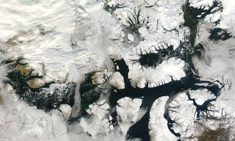 |
Uncharted ... the Northwest Passage from space. Photograph: AP/NASA
Within the space of a week two ships have been involved in accidents in the Northwest Passage, fuelling debate on the environmental risks associated with shipping north of the Arctic
Circle, despite the waters being increasingly ice-free in the summer.
Both accidents were blamed on navigation problems, drawing attention to a
lack of proper charts for the region.
In late August the cruise ship Clipper Adventurer was heading for Kugluktuk, at the entrance to the passage, when it struck a rock not shown on the map, according to the captain of the ship. The Canadian Coast Guard sent an icebreaker to rescue the 110 passengers, taking them to the ship's next port of call. The condition of the ship – still stuck but said to be "stable" by CCG spokeswoman Chantal Guénette – is being closely watched until it can be refloated.
The MV Nanny, a small Canadian oil tanker, suffered a similar fate on 1 September, running aground on a sandbank in the western part of the passage. Here again a CCG icebreaker soon reached the ship, which was carrying 9m litres of diesel fuel for remote Nunavut communities. An inspection of the vessel confirmed that "no damage has been detected and there are no leaks", said Guénette. The ship's master also blamed the grounding on inaccurate charts.
Louis Fortier, the scientific director of ArcticNet, the main network of Canadian researchers working in the Arctic, is not surprised at the accidents. "Only a tenth of the region is properly mapped," he said.
Dale Nicholson, the head of the Arctic region at Canada's Hydrographic Service, confirmed this figure.
He reckons there is no need to map the whole of the Canadian Arctic for it to be possible to navigate the main channels "but we obviously need more than 10%".
Highly specialised, relatively expensive equipment is required to map the seabed. The Hydrographic Service lacks the financial resources to speed up the process, yet time is running out, says Fortier. "Between 1906 – when the Norwegian explorer Roald Amundsen first negotiated the passage – and 2009, 69 ships took this route. This year, in only seven months, 24 ships have already passed through and most of them are cruise ships. If we want to prevent a rash of accidents, we must make mapping the Arctic a priority," he said.
But it is impossible to control everything. Cruise ships sail too close to the land to give passengers a better view, straying from the properly charted central channel.
This article originally appeared in Le Monde
This article was amended on September 14. It originally read "Highly specialised, relatively expensive equipment is required to map the seabed. The Hydrographic Service lacks the financial resources to speed up the process, yet time is running out, says Nicholson."